On Google Play for Android
WeRide

Ride together with WeRide.
Stay connected.

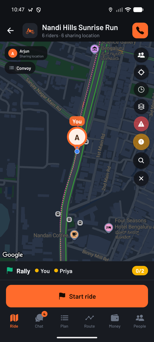
The WeRide app puts your riding group on one map: live positions, navigation to the rally point, calls and chat, shared expenses and an SOS that reaches the group. Made in Bengaluru, India, and free on Android.

Get it on Google Play See Features
Live
Every rider on one map
Android
On Google Play
Free
No subscription, no ads

What the app does for a riding group

From planning the route to riding it to splitting the fuel afterwards. Everything below is in the app today.

☰

Rally point navigation

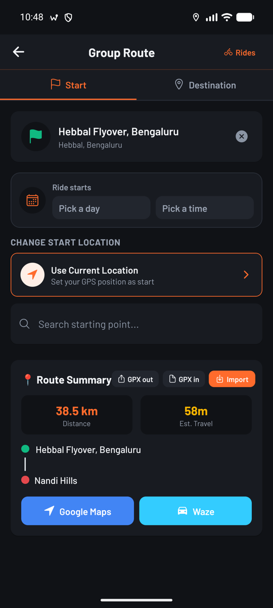
Set a meeting point, choose between routes, and navigate together with turn-by-turn voice guidance. Everyone's position stays on the map as you go.

⚑

Leaders and tails

Name who rides at the front and who sweeps at the back. When a rider drops behind the last tail, only the leaders, tails and organisers hear about it.

●

Live group tracking

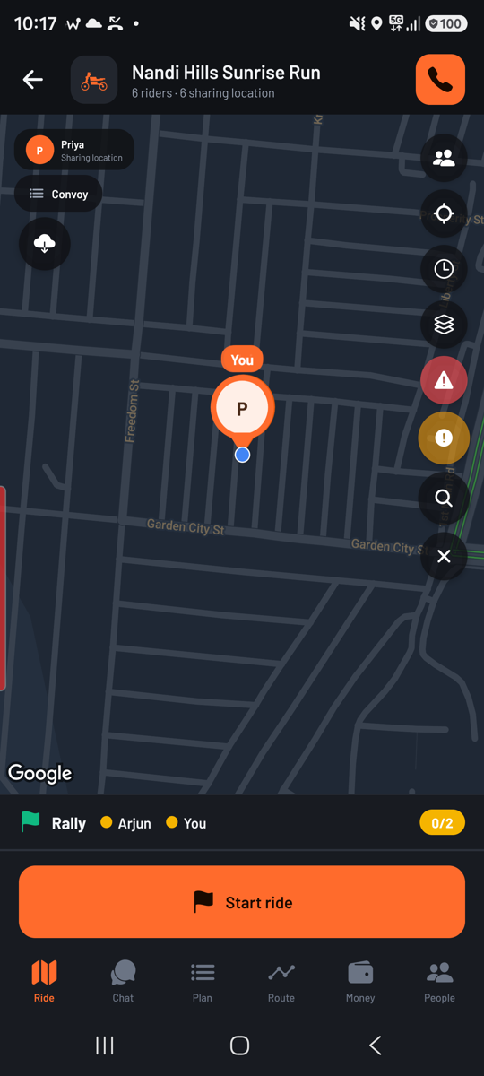
See every rider's live location, speed, distance and arrival time. A convoy strip shows how far the group is spread along the route.

★

Expenses, split

Log fuel, food, tolls and anything else. Split equally or by share. Spend in more than one currency and the app converts it.

✉

Calls, group calls, chat

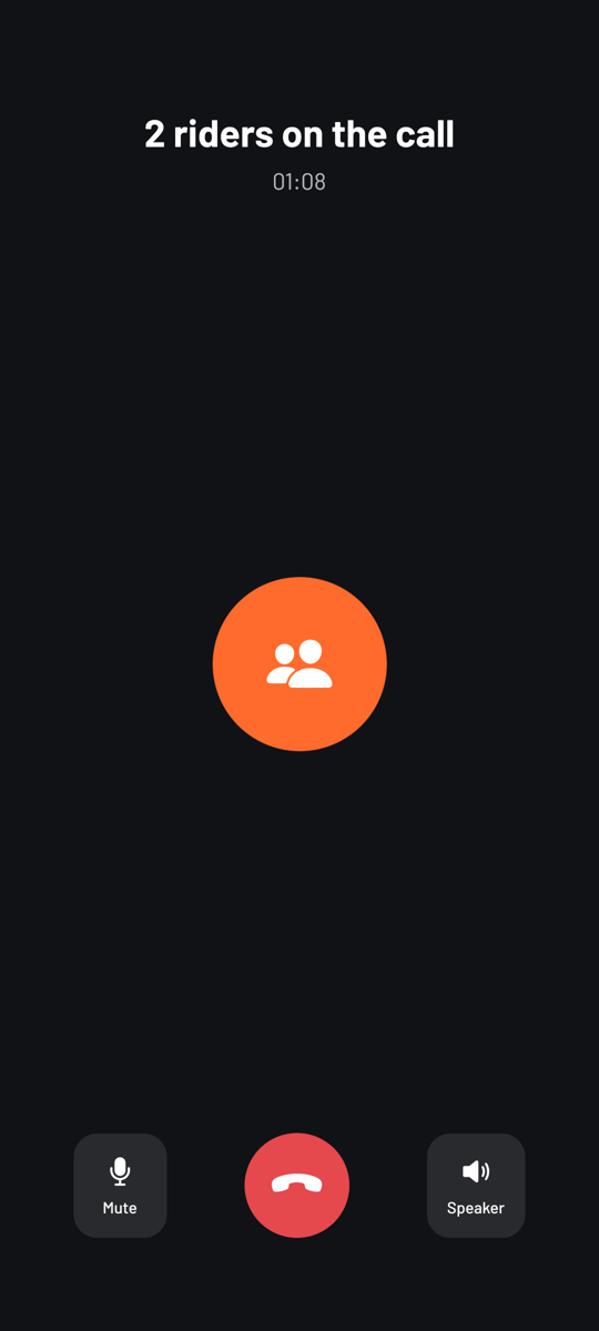
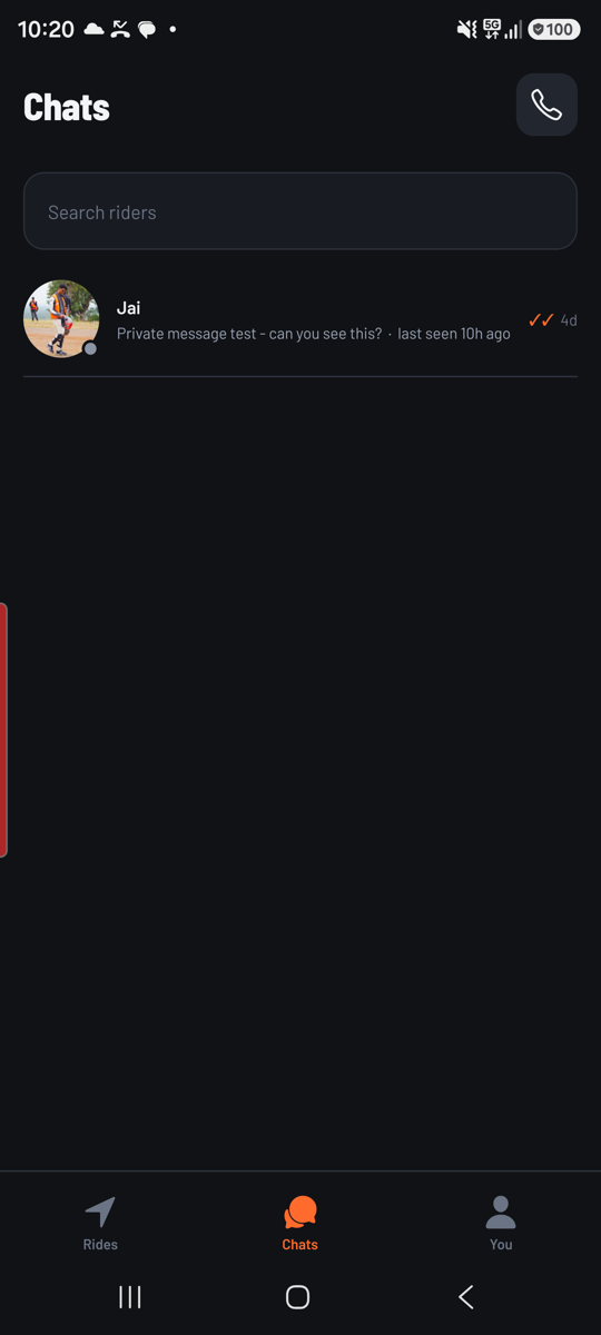
Voice and video calls between riders, group calls that ring everyone on the map, and a Join button if you missed the start. Chat with photos, files, voice notes, polls, pins, replies and disappearing messages.

⚠

Safety

One-tap SOS to the group, crash detection that raises the SOS for you, hazard reports on the shared map, an emergency card responders can read, and rest reminders on long rides.

⚙

Garage

Keep more than one bike or car. Log fuel and see your efficiency, record services and maintenance, and run a pre-ride checklist before you set off.

▭

Made for the handlebar mount

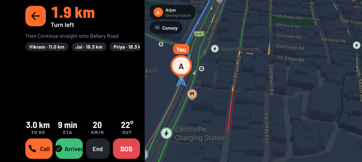
Turn the phone sideways and the map fills the screen: no status bar, no clutter, a rider strip you can read at arm's length and a re-centre button sized for gloves.

↓

GPX in and out

Bring a route from Kurviger, calimoto, REVER or any planner, and export your routes and recorded rides to share anywhere.

▦

Ride day and time

Set when the ride starts and when to arrive. Your next ride leads the Rides page, and an itinerary dated for a different day is flagged before anyone turns up on the wrong one.

≋

More than one way there

Alternative routes are shown side by side with their distance and time, so the group picks one before it sets off rather than at the fork.

▶

Watch the whole trip back

Every recorded trip replays on the map with the route drawing itself, your bike riding it, and the places named as you reach them: where you set off, where you stopped, where each day ended, where you arrived. Wind through a three-day tour in twenty seconds, or open one day and watch just that. Ask for a video of it and the app builds one and saves it to your phone.

◈

Cards worth the ride

Not badges for opening the app. Distance in a day, nights on the road, rally stages without speeding, laps held together — earned by riding, with each card showing how few riders hold it. The hardest sit in titanium, carbon and graphene, and most riders will never see them.

◎

GPS that works the road out

A phone's GPS is an opinion with an error bar, and most apps throw the error bar away. WeRide keeps it, and works out from the fixes themselves how hard you are riding — so it smooths a motorway hard and still follows a switchback, discounts a reflection off a building, and knows a bike parked at a fuel stop from one creeping through traffic. Nothing about your road is assumed in advance. Measured against a known route, a ten kilometre ride reads 10.1 km where the raw fixes read 11.

◆

It survives the phone

Rides, tours, lap times and stages live on the server as well as in your pocket. Change handset, lose one, pick up a spare in the paddock: your season is already there when you sign in.

◌

Map a track by riding it

Every circuit we know of is on the server with its shape, its corners numbered and its elevation drawn. Anywhere that is not — an airfield, a closed road, a private track — you map yourself: ride to the start line, do three laps, ride the pit lane slowly, name it. It is yours, on your phone and on the server, until you share it with a group or with one rider by name.

⚑

Rally stages, vouched for by riders

Plan a stage of up to fifty places by name, by coordinates or by pressing on the map, on the road or off it, or import a GPX with its heights. Put it up for other riders and it is marked unverified until riders who have ridden it vouch for it; the count is on the map, so a new rider knows what they are taking on. Routes WeRide has checked are marked verified.

◉

Your own bike on the replay

Replays and circuit maps are drawn from OpenStreetMap data on our own storage, so the trip you replay is yours to keep and to share. Pick what rides it: naked, full-faired, adventure or cruiser — or hatchback, coupé, sedan, SUV, 4×4 or van.

Three ways to record a ride

A track day and a month to Ladakh are not the same recording problem. Pick the one that matches what you are doing, and the app records at the rate that job needs.

All three are in beta, and free while they are. They work and they are tested, but nobody has yet timed a real track day with one or followed a real roadbook on one, and until somebody has we would rather say so. They will be paid for one day. The app will tell you long before that happens.

Beta · closed courses only

Race

Laps, sectors, speed and lean angle, corner by corner. Fifty sensor samples a second, so a corner you got wrong is still there afterwards at the resolution you took it.

The start line is set by riding across it — no pinching a satellite view with gloves on — and every crossing is timed between the two fixes either side of it rather than snapped to the nearer one, which at 200 km/h is the difference between a lap time and a guess. Ride at a circuit we recognise and the session is stamped Verified and ranked against everybody else there, split by engine class.

Records at
50 Hz
Measured in
Laps
Runs for
Minutes
Beta · roadbook and odometer

Rally

Stage times, waypoints and speed zones, with the map optional, as it should be. Ten samples a second settles an argument about a stage and is still light enough to run all weekend.

The odometer is the instrument, so you can calibrate it against a known distance, and it keeps that correction until you change tyres. Waypoints only count in the order the roadbook has them. Speed zones are measured, not judged: how far over, for how long, over what distance. The penalty belongs to whoever is running the event.

Records at
10 Hz
Measured in
Stages
Runs for
Hours to days
Beta · however many days it takes

Endurance

One tour, however long. Every kilometre kept with the screen off and with no signal, and the nights and the tea stops kept as part of the journey rather than as gaps between rides.

Whatever you record is yours on the next phone too. The summary and the raw trace both go to the server, so a session can be re-timed or re-measured later on a handset that was never there when you rode it.

Records at
1 Hz
Measured in
Days
Runs for
Days to months

Race mode will open anywhere, because no database knows which road is closed today. What it asks instead is that you say so: you confirm the course is closed to traffic before it will record a lap.

The app, as it looks on the bars

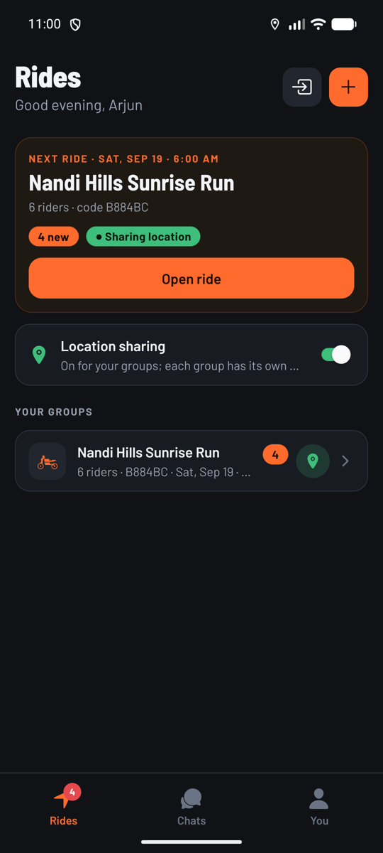
Straight from the phone: the next ride, the ride map, a group call, the route planner, the places finder and chats.

Ride Mode sideways, full screen with turn-by-turn and the riders around you

Help reaches you faster

The app cannot stop a crash. What it can do is make sure the people who can help know where you are.

Crash detection

The phone's sensors watch for a hard impact followed by a stop: after 12 seconds without movement (10 on a track) you get 48 seconds to say you are fine. If you do not, an SOS goes to your group with your location and a message is drafted to your emergency contacts.

Emergency SOS

One tap sends your live location to everyone in the group, and opens a text to your emergency contacts with a map link.

Emergency card

Blood group, allergies, medication and who to call. The group's leaders and tails can read it when it matters, and every read is announced in the group and logged.

Hazard reporting

Report a hazard from the map and every rider in the group sees the marker straight away.

Rest reminders

A reminder every two hours of continuous riding, so the stop is planned rather than forced.

Battery sharing

See every rider's phone battery, so you know who is about to drop off the map before they do.

Who rode the furthest

Published from the app, by distance ridden rather than speed. Riders appear by first name only. In the app there are class boards too, a top ten by engine size and a top ten by kind of bike, so a 200 is not made to race a litre bike to be worth a place.

Top Ten Riders

Loading

Top Ten Groups

Loading

What riders ask before they install

The short answers. Everything here is what the app does today, not what is planned.

Is WeRide free?

Yes. There is no subscription and no advertising, and nothing is charged for today. The three riding modes are meant to be paid for one day and are free while they are in beta; the app will say so well before that changes.

What is the best app for tracking a group of riders?

That is what WeRide was built for. Every rider in the group appears live on one map with their speed, distance and arrival time, and a convoy strip shows how far the group is spread out, so you know who is behind before you find out at the next stop.

Can I share my live location with my riding group?

Yes, and only with the groups you choose. Sharing is per group, can be switched off at any time, and stops when the ride ends. The app is not following you the rest of the week.

Does it work for cars as well as motorcycles?

Yes. The garage holds motorcycles and cars, and everything else works the same either way.

What happens if a rider crashes?

The phone's sensors watch for a hard impact followed by the bike coming to a stop: after 12 seconds without movement (10 on a track) the rider gets 48 seconds to cancel, and if nothing happens an SOS goes to the group with their location, and a text to their emergency contacts is prepared on the phone.

Does everyone in the group need the app?

For live positions, yes. A planned route or a recorded ride can be exported as a GPX file and shared with anyone, app or no app.

Can I bring a route in from another planner?

Yes. WeRide imports GPX from Kurviger, calimoto, REVER or anything else that exports it, and sends your own routes and recorded rides back out the same way.

Is WeRide made in India?

Yes. WeRide is made in Bengaluru, India, and is free on Google Play. It works wherever you ride, with distances in kilometres or miles as you choose.

Is there an iPhone version?

Not yet. WeRide is on Android, through Google Play.

Ready to ride together?

Install WeRide, make a group, share the six-character code, and ride. Free, with no subscription.

Get it on Google Play